
A design that reconsiders the 211 acre Bellingham Waterfront District site as a forward-thinking extension of Bellingham’s urban fabric designed specifically to counteract the site’s toxic past and propel Bellingham into a sustainable future. Inspired by the 2011 Living City Design Competition, I used the International Living Future Institute’s [ILFI] Living Community Challenge [LCC] 1.2 framework to guide my design as I developed a masterplan connecting the currently isolated waterfront to Bellingham's city center. As a Living City, not only would this masterplan fill in an important gap in Bellingham's urban fabric, it would also contribute to a sense of Place, be net-positive Water, be net-positive Energy, inspire Health & Happiness, be built using local Materials, promote Equity, and inspire Beauty. Here's how!
![view from tidal lagoon trail [former ASB] toward mt. baker](https://cdn.myportfolio.com/eae1339f-f273-4a23-b186-7b388f652efb/7a1cf93e-3dd0-4d19-8670-b0dd755214b8_rw_1920.jpg?h=5d504a6331fc15c2ffbd0c9231bfa612)
view from tidal lagoon trail [former ASB] toward mt. baker

existing site

industrial relics

toxic past
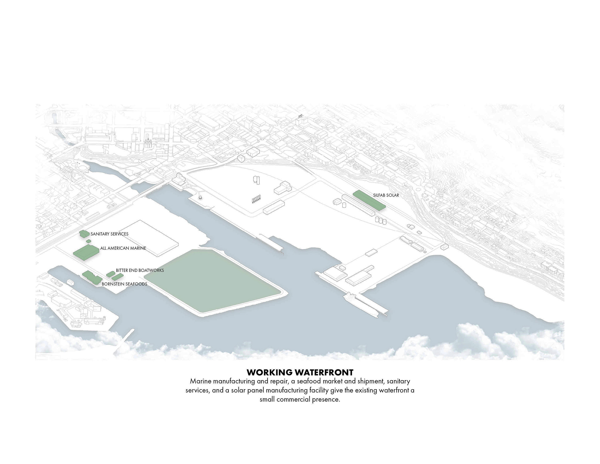
working waterfront
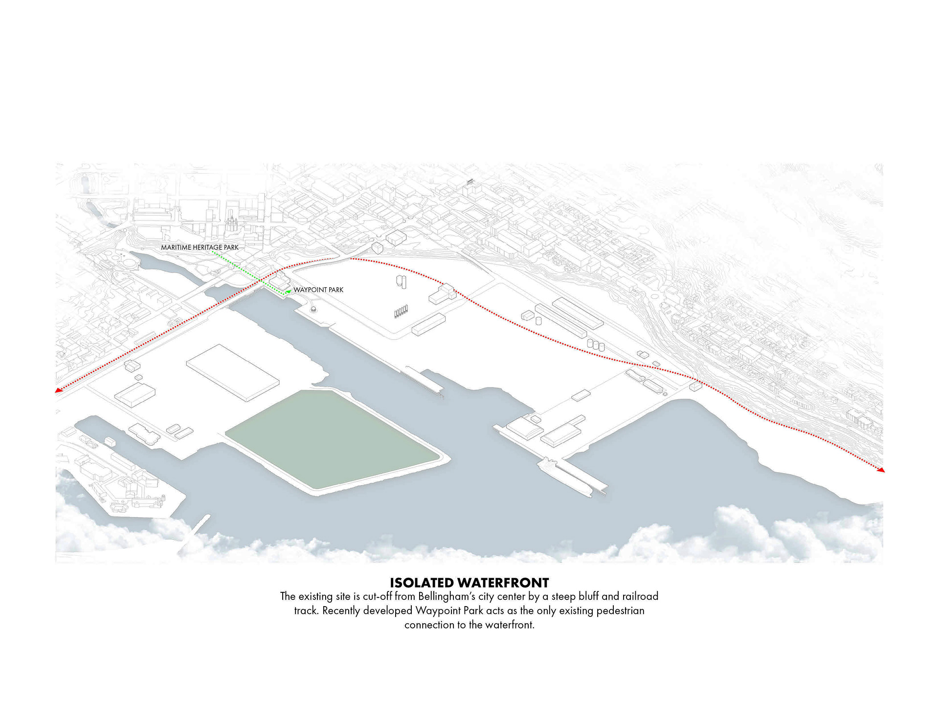
isolated waterfront

continuous public waterfront
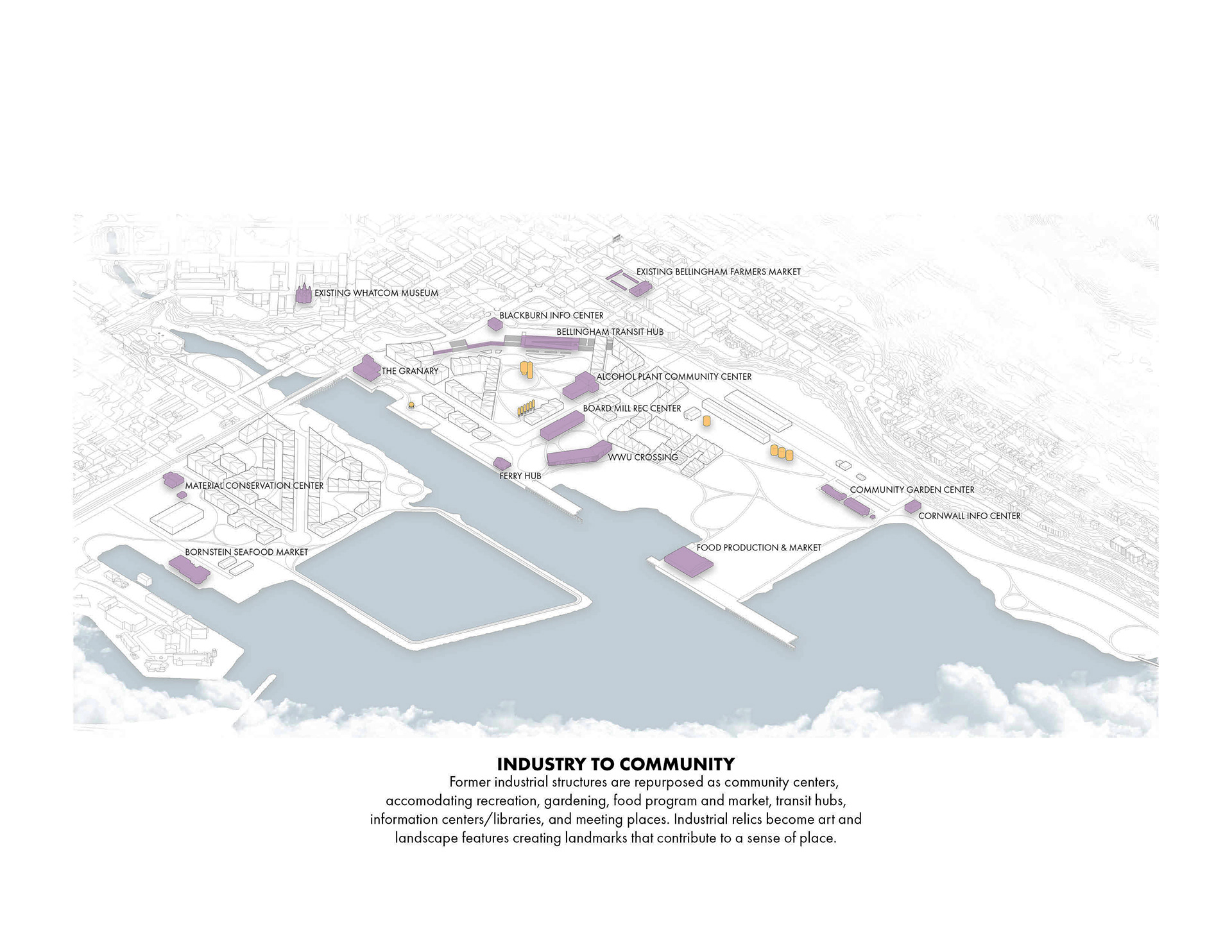
industry to community
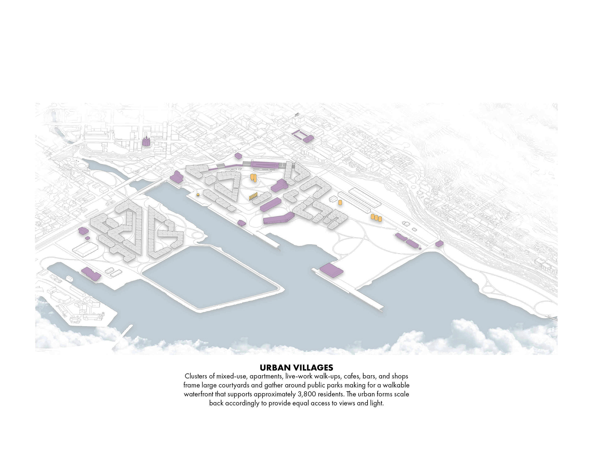
urban villages

visual axis'
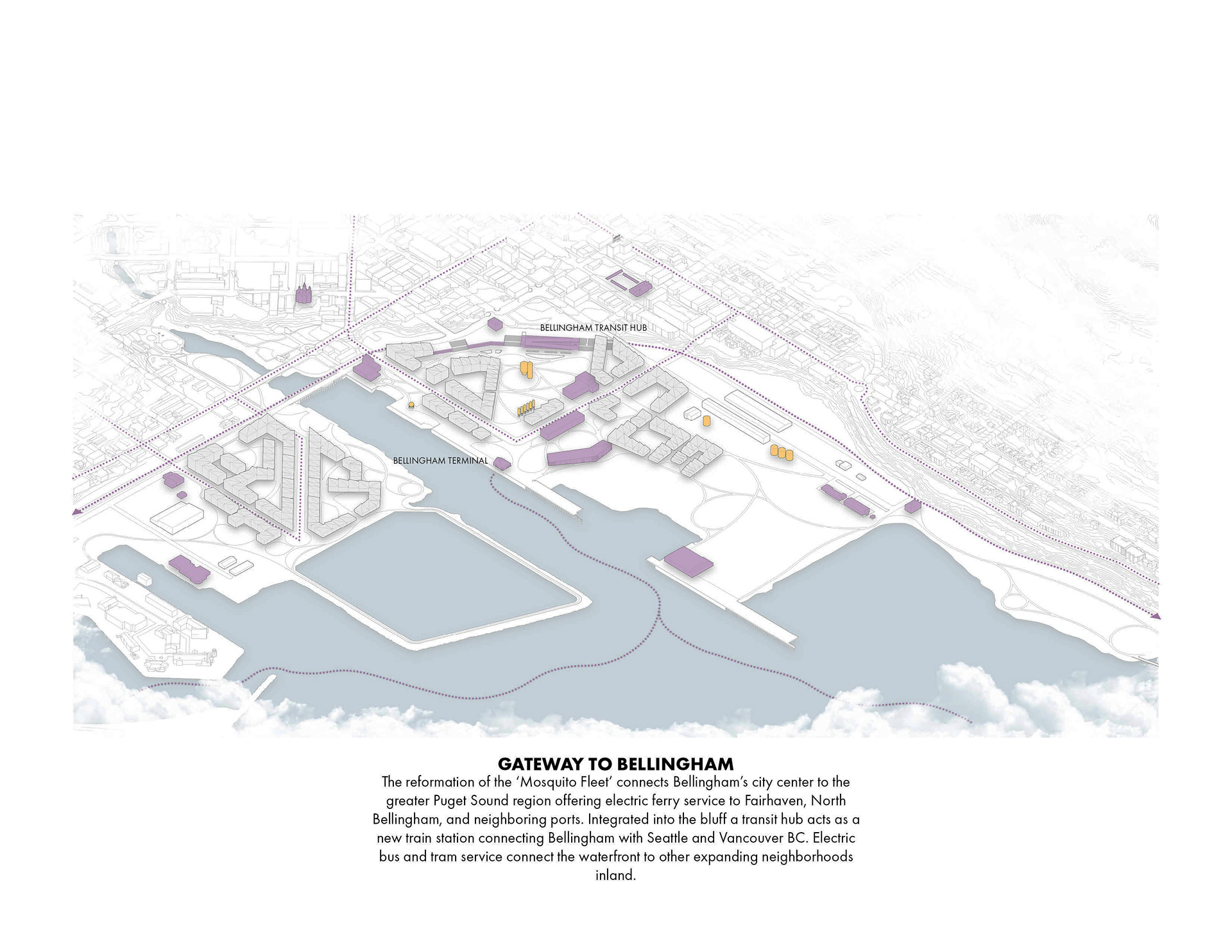
gateway to bellingham
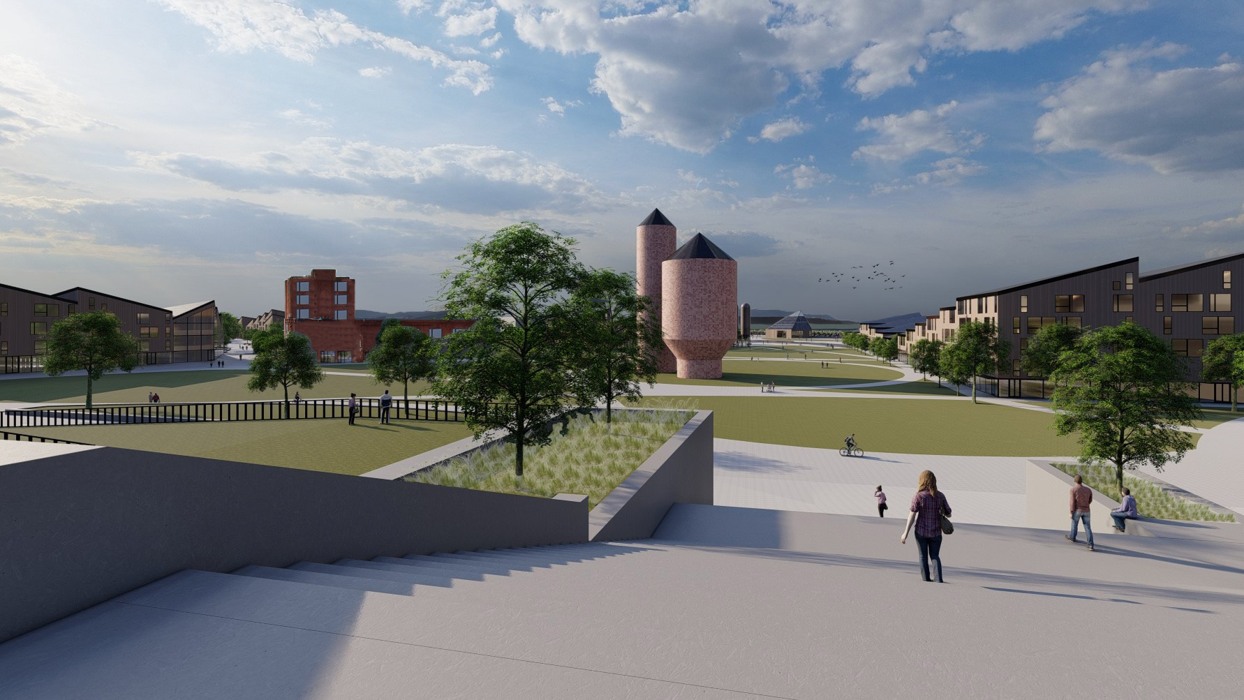
Place
Limits to Growth | Urban Agriculture | Habitat Exchange | Human Powered Living
The intent of the Place Petal is to ensure that communities build only where it is appropriate to build, reduce or eliminate their dependence on single occupancy vehicles, and are able to support themselves without reliance on globally sourced food production. The Living Waterfront aims to achieve these ideals by adhering to the following four imperatives; Limits to Growth, Urban Agriculture, Habitat Exchange, and Human Powered Living. The Waterfront District’s “Limit(s) to Growth” was the 100-year flood plain. No buildings in this development will be constructed within the 100-year flood plain boundary making this area an ideal location for habitat restoration. To reduce dependence on globally sourced food production the Bellingham Shipping Terminal will be converted to urban agriculture providing locally sourced food, making use of one of the existing warehouses. The Living Waterfront will be walkable, rather than connecting shops and apartments with roads and sidewalks the neighborhoods will be connected by parks and bike trails. The development will include an extension of the Taylor Dock South Bay Trail with a boardwalk from Boulevard park to Cornwall Beach park connecting Downtown Bellingham to Fairhaven as well as offering sweeping views of Bellingham Bay. 211 acres will also be set aside by KCLT for habitat.
view from corner of granary and w. laurel st. toward mt. baker
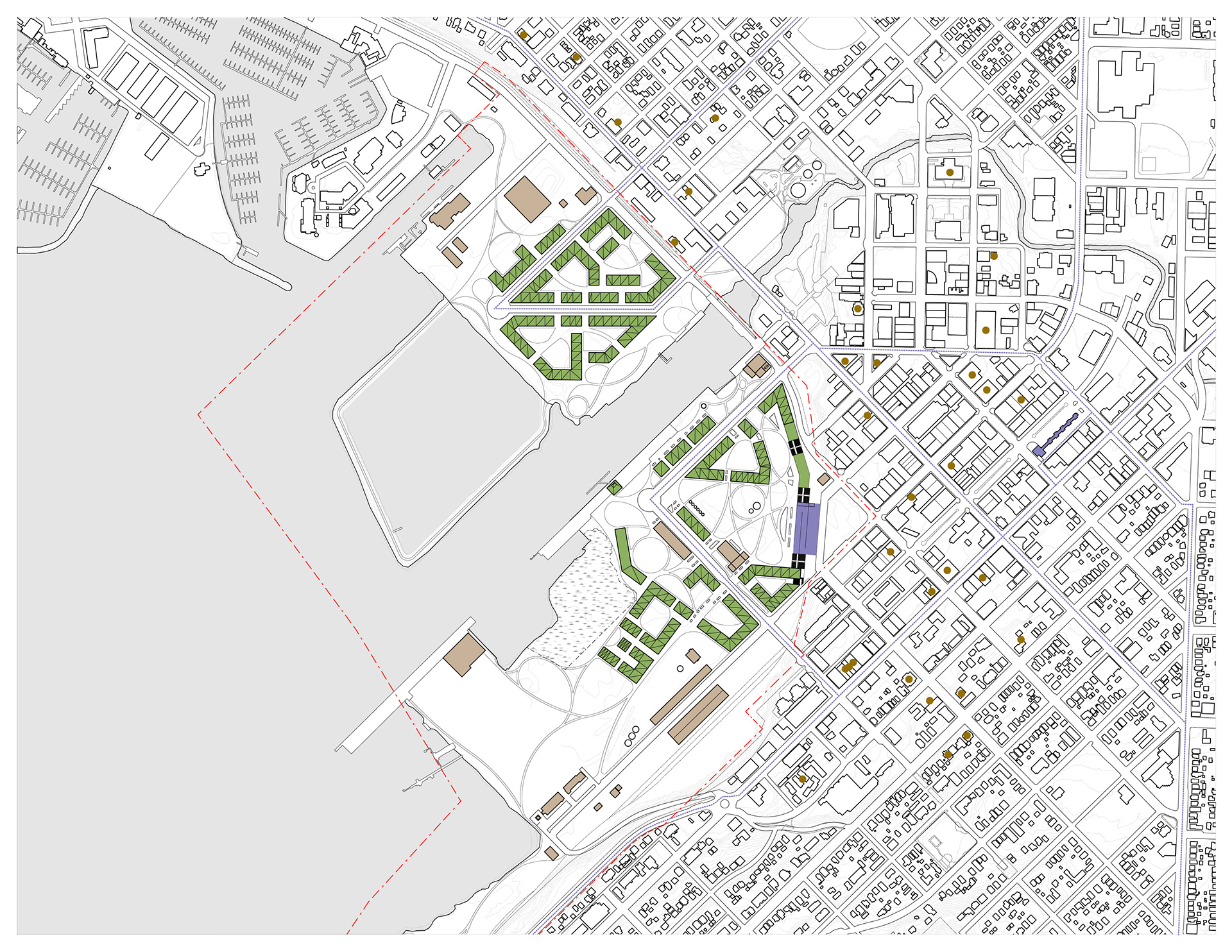
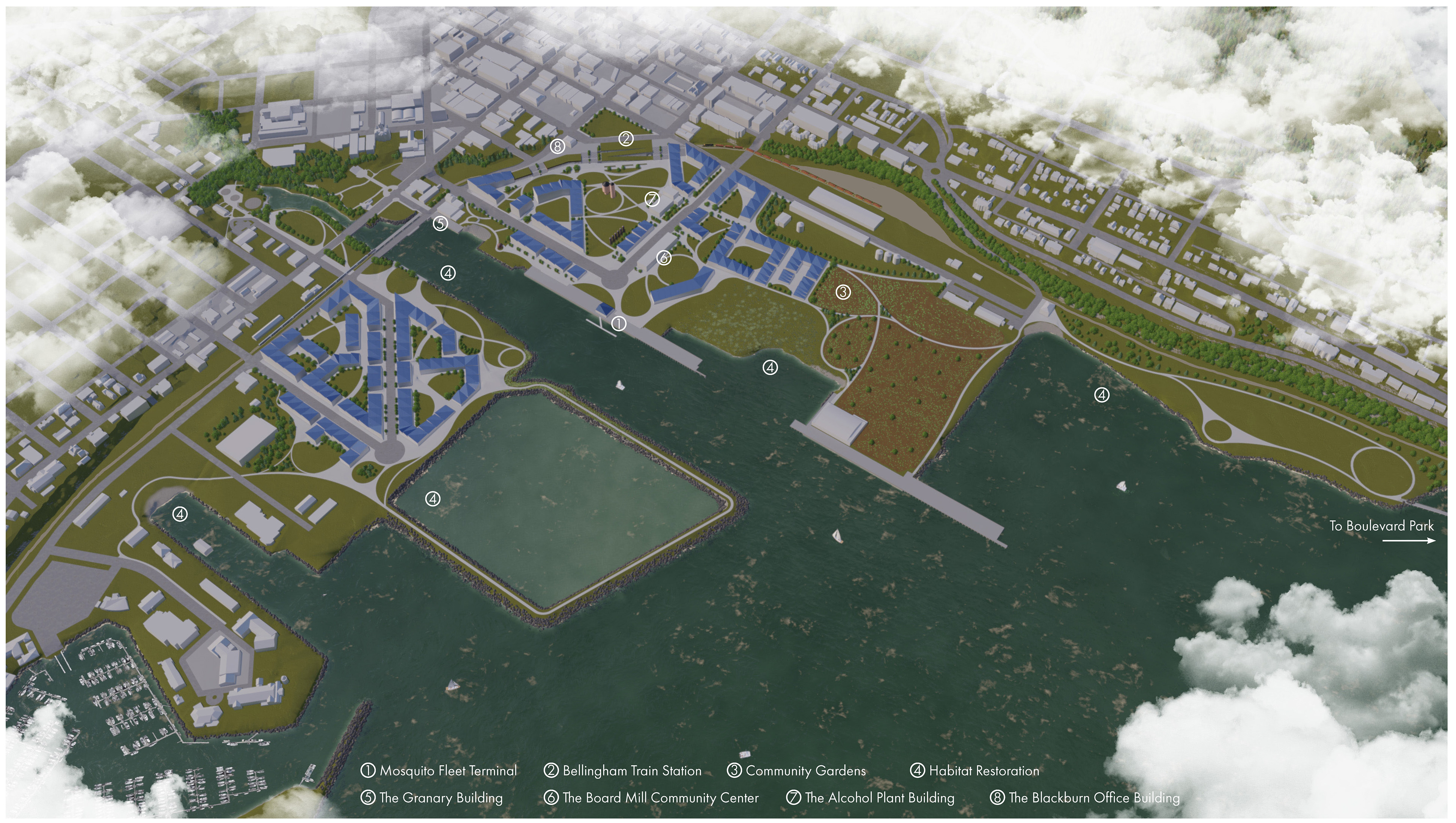
site plan: green fill denotes new construction, brown fill denotes existing structures, purple fill denotes the transit hub, brown dots denote historic sites
Living Waterfront Key Metrics
Total Area: 211 acres
Building Footprints: 28.1 acres
Roadway + Parking: 30.8 acres
Current Waterfront Population: 0 residents
Projected Waterfront Population: 3,802 residents (1,646 residential units [2018 C.O.B. Sub-Area Plan] x avg. 2.31 persons per household [2019 US Census Bureau: Bellingham, WA])
Required Urban Agriculture: 22.4 acres
Water
|Net Positive Water|
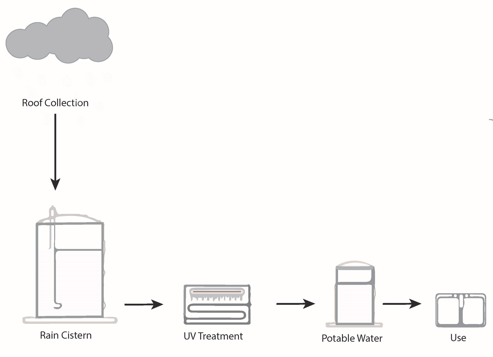
The Water Petal demands a new relationship between a community and both its water supply and wastewater treatment process, understanding water as a valuable resource, drawing from natural closed loop water systems. This development proposes Bellingham’s Waterfront District as a water-independent community, relying only on rainfall and greywater recycling to sustain its water supply. In order to achieve net positive water, rainfall will be collected and undergo a treatment process modeled after both the Bullitt Center in Seattle as well as the San Francisco Public Utilities Commission (SFPUC) Living machine. Both precedents were inspired by natural systems appropriate to the Cascadia Bioregion. The Bullitt Center’s rainwater harvesting system was modeled after a Douglas fir forest and SFPUC’s Living Machines modeled after tidal wetlands. Rainwater from rooftops will be stored in cisterns before being passed through a disinfection system before it becomes potable where it will then be recycled by a greywater system for non-potable uses (toilets, laundry, etc...) to scale back typical water demand. Storm water and waste water can be treated by Living Machines dispersed throughout the neighborhoods by passing the water through a series of carefully constructed wetlands before re-entering the disinfection system (shown below). These Living Machines are safe for humans to interact with on the surface.

living machine: biological water treatment
rooftop catchment
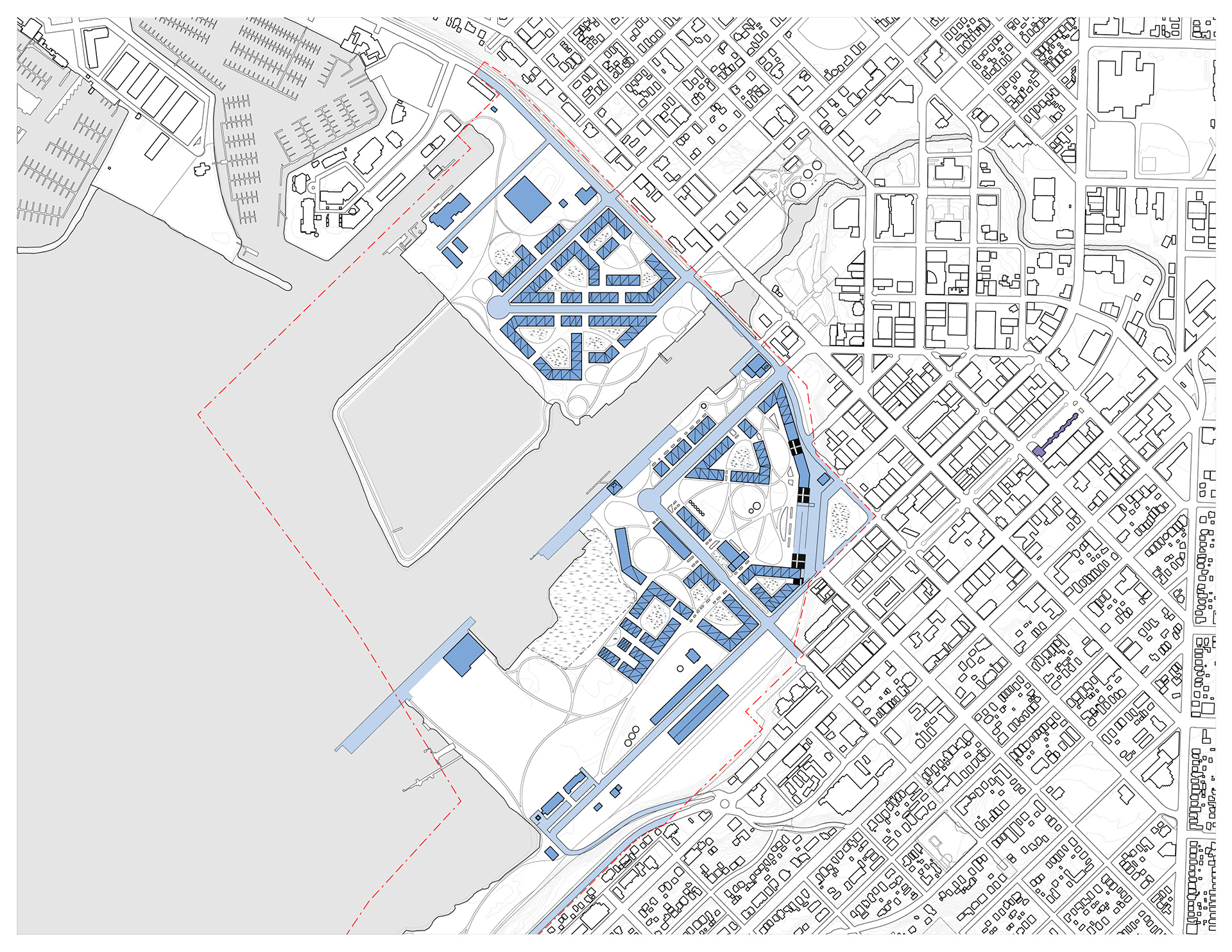
site plan: dark blue denoting rooftop water catchment surface area, light blue denoting impervious surface water catchment area, marsh hatch denoting living machine surface area
Living Waterfront Key Metrics
Average Annual Rainfall: 36.29 inches (34.48 inches captured)
Total Catchment Area: 58.9 acres
Rooftop Catchment Area: 28.1 acres
Other Impervious Surface Catchment Area: 30.8 acres
Total Water Captured: 53,107,321.26 gal. per year (25,301,283.23 gal. per year Rooftop + 27,790,810.18 gal. per year Other Surfaces)
Projected Usage per Person: 80 gal. per day down to 38 gal. per day with greywater recycling
Projected Community Demand: 52,737,346.2 gal. per year = NET POSITIVE WATER
Required Area for Living Machines [biological wastewater facilities]: 0.3 acres
Energy
|Net Positive Energy|
The Energy Petal aims to create communities that can rely solely on renewable energy to power a decentralized grid without any use of combustion. To achieve net positive energy the Living Waterfront District will rely primarily on solar energy, generated from rooftop photovoltaic arrays installed on both new construction and the existing building stock. It will also harness tidal energy generated from a tidal lagoon that will replace the former Aerated Stabilization Basin. Modeled after the Swansea Bay Tidal Lagoon in Swansea, Wales, as tides rise gates installed within the breakwater will keep the basin from reaching high tide. At high tide the gates open allowing water to fill the basin through a series of turbines, the process then works in reverse as the basin transfers water back to the bay. Energy from these sources will be put into a district-wide grid and redistributed as needed from the current PSE Ecogen Power Station on Cornwall Avenue which will be converted into local energy storage.

tidal energy diagram
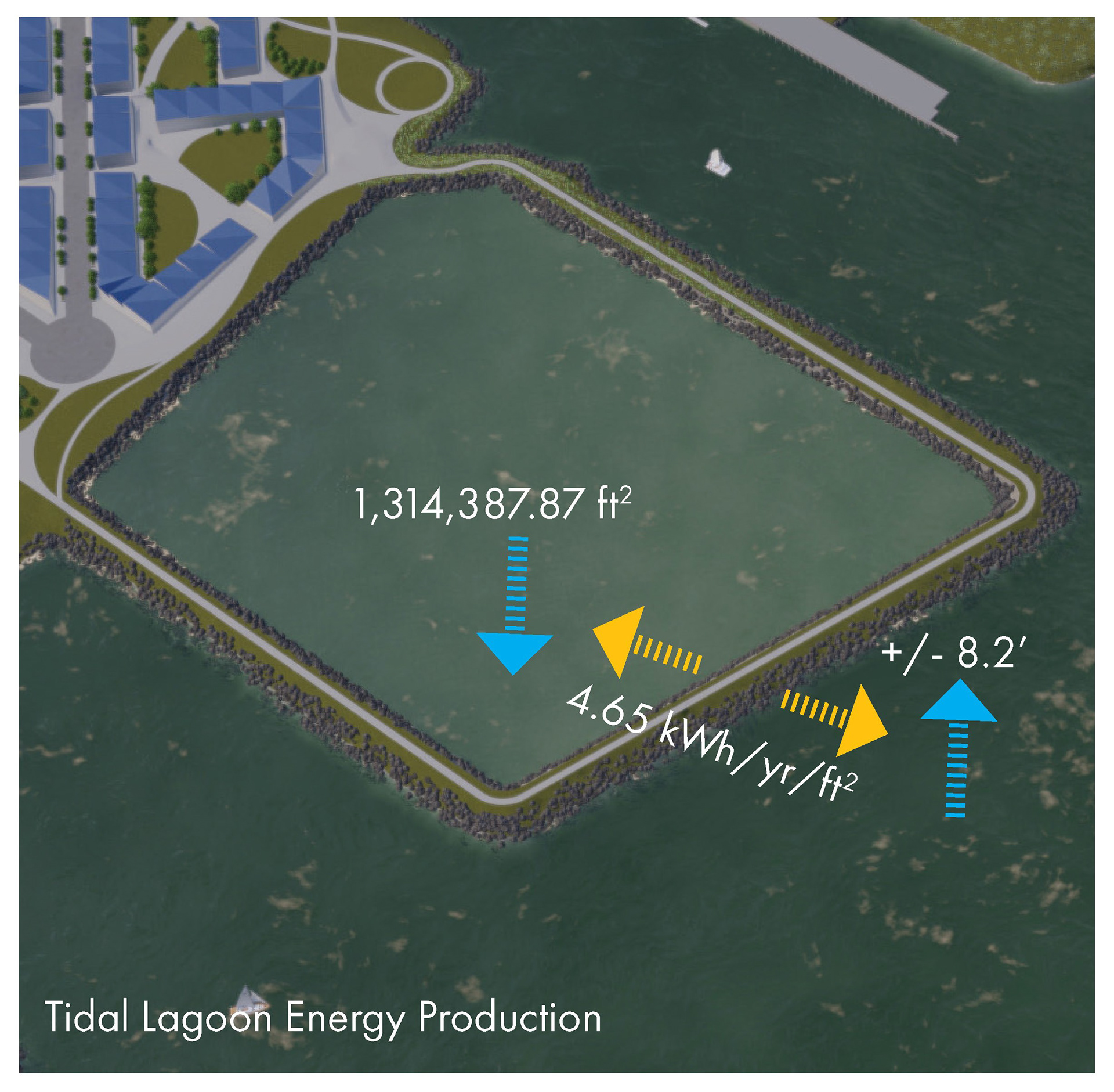
tidal lagoon diagram
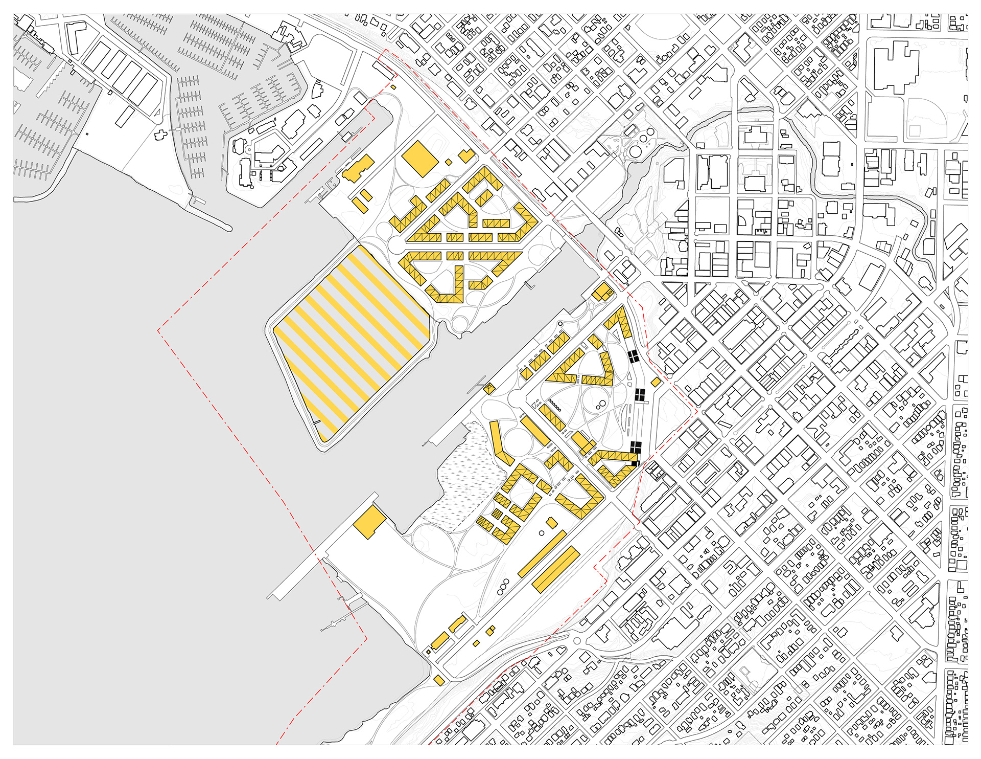
site plan: solid yellow fill denoting rooftop PV array surface area, patterned yellow fill denoting tidal energy lagoon area
Living Waterfront Key Metrics
Average Annual Energy Use [2018]: 10,972 kWh/yr/household
Projected Annual Energy Use [2050]: 15,085.85 kWh/yr/household
Average Annual Community Energy Demand: 24,831,307.66 kWh/yr
Total PV Array Area: 1,145,252 sf
PV Array Energy Generation: 18,814,857.41 kWh/yr
Tidal Lagoon Area: 1,314,387.87 sf
Tidal Lagoon Energy Generation: 6,107,750.33 kWh/yr
Total Energy Production: 24,922,607.70 kWh/yr = NET POSITIVE ENERGY
Health & Happiness
Civilized Environment | Healthy Neighborhood Design | Biophilic Environment | Resilient Community Connections
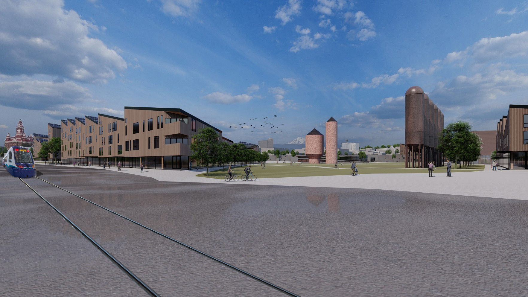
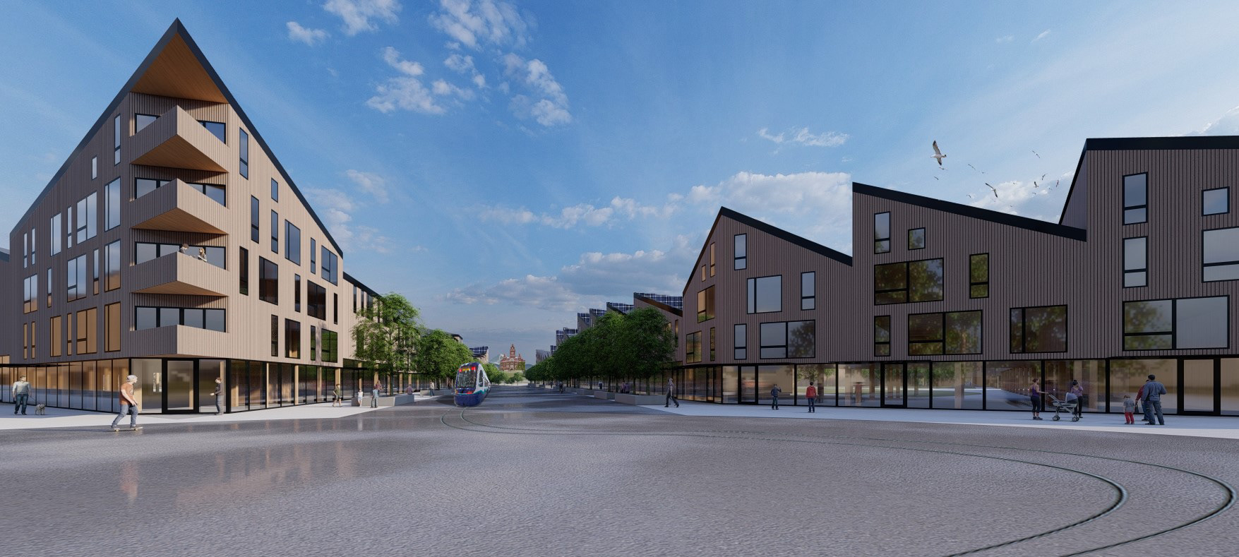
The Health and Happiness Petal is intended to be about the human experience at every scale. The Living Waterfront District will include a train station, community garden plots, pedestrian ferry terminal, and community gathering spaces both indoor and outdoor. Residential and commercial buildings encircle small plazas and are separated by pedestrian greenways connecting residents to the larger system of parks and trails creating a unique urban village quality. Existing buildings such as the Granary, the Board Mill, the Alcohol Plant, and the Blackburn Office building will be re-purposed to hold community functions. Long stretches of public shoreline ensure equal access to the water. The Tidal Lagoon Trail will become a prime location for wildlife watching along Bellingham Bay. Cornwall Beach, the Log Pond, and the I & J Waterway will also be undergoing habitat restoration projects to protect eelgrass and salmon habitat.
Materials
Living Materials Plan | Embodied Carbon Footprint | Net Positive Waste
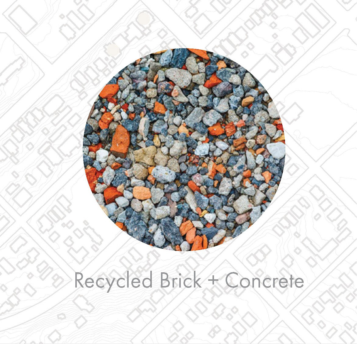
The purpose of the Materials Petal is to promote a sustainable and equitable materials economy and furthermore remove the most toxic materials from the built environment. The Living Materials Plan for the Bellingham Waterfront uses primarily products that have the “Declare Label” and are of course Red List free. This is essentially a nutrition label for building products to ensure transparency and promote responsible industry. As part of the Living Materials Plan, The Living Economy Sourcing Imperative in the LBC states that you must get a vast majority of your materials within 1000km of your site. All of the materials in the Living Waterfront project will be sourced from inside of 300 miles away. The Waterfront District will be a mass timber development utilizing the efficiency and low carbon footprint of CLT panels sourced from Penticton BC. These mass timber structures will be clad in Western Red Cedar siding sourced from Portland OR and will be finished with local millwork. Net Positive Waste will be achieved by finding adaptive re-uses for many buildings on site. Buildings that are demolished are primarily concrete and brick construction which can be utilized as part of breakwaters and pathways minimizing the material that will need to be brought into the site.
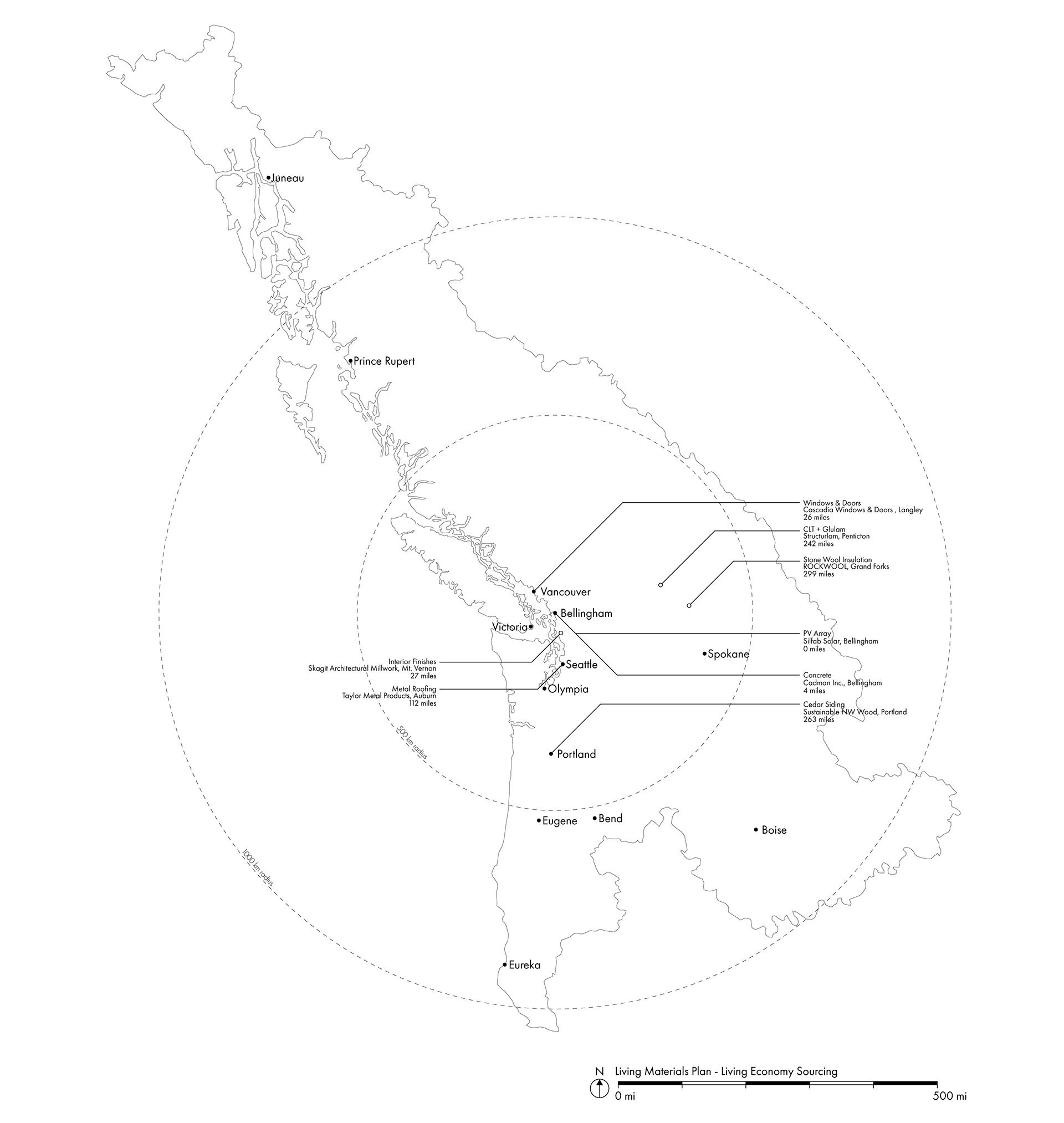
living economy sourcing
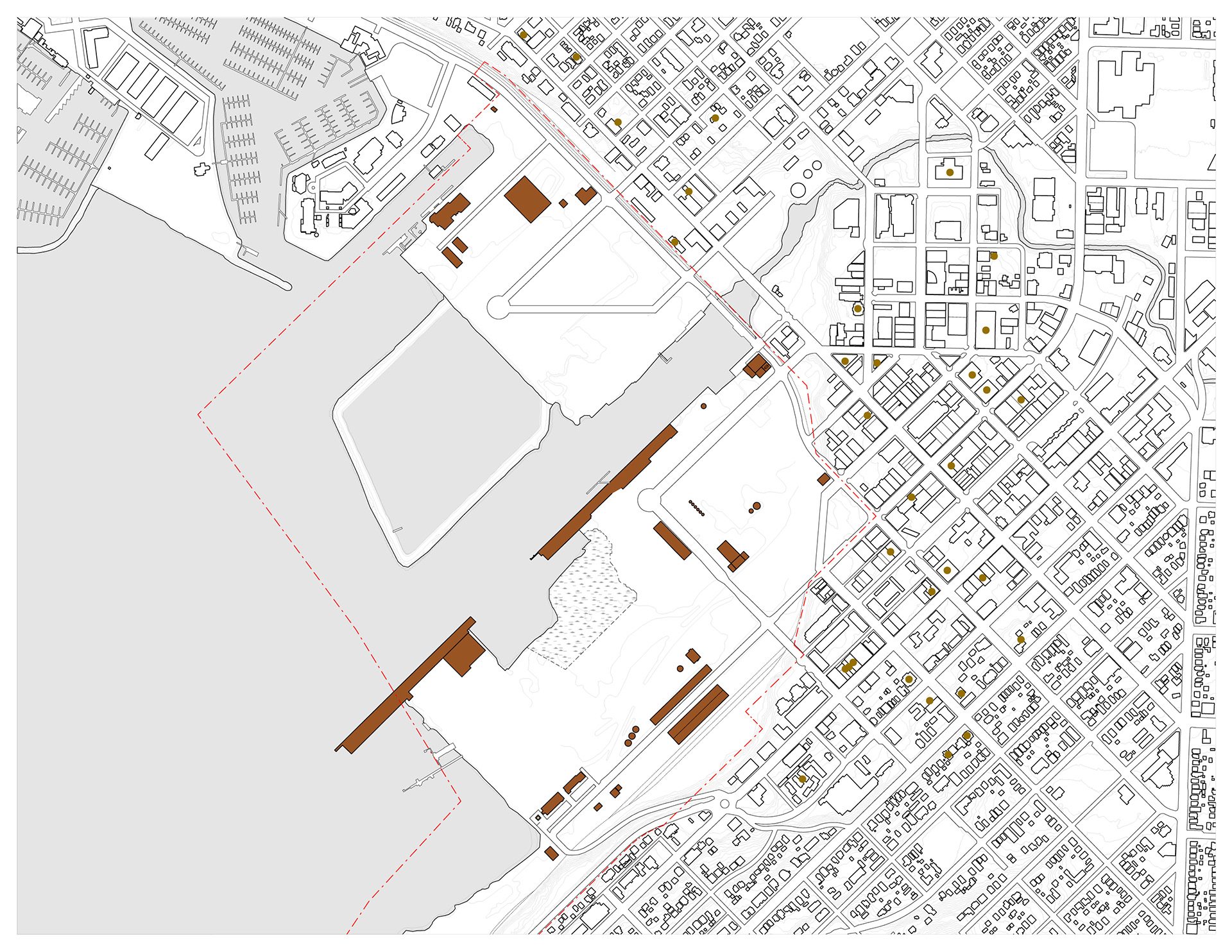
site plan: adaptive re-use of existing structures
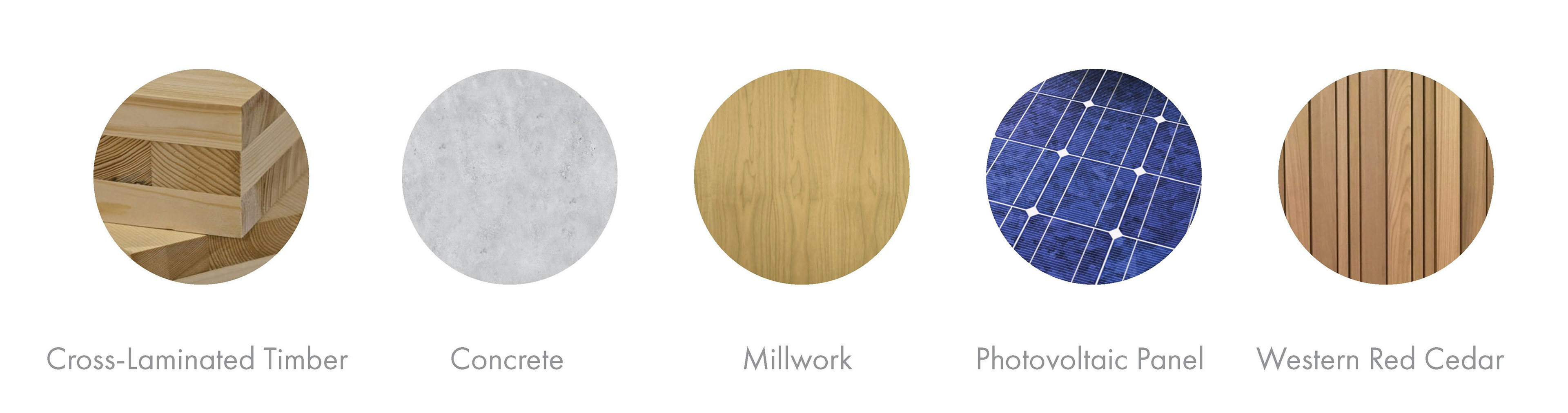
material palette
adaptive re-use
Equity
Human Scale + Humane Places | Universal Access to Nature + Place | Universal Access to Community Services | Equitable Investment | Just Organizations
The Equity Petal aims to build a sense of community, combatting development trends such as enclaves for the wealthy and privatized nature. Universal access to services and nature is the goal. The Living Waterfront addresses this by making the entire shoreline a public domain, to be enjoyed by residents and visitors alike. Trails connecting neighborhoods to Whatcom Waterway, I & J Waterway, and Bellingham Bay make it possible for anyone in the Bellingham or Fairhaven to access these spaces. Occupiable green roofs provide a transition reconnecting Downtown with the Waterfront District allowing pedestrian traffic to move safely over the railroad tracks. Residential units offer sweeping views of the bay by gradually stepping down in height to the south, ensuring that everyone gets views and quality daylight. Streets and trails lined with trees offer shade and help provide a sense of scale on larger streets. Western Crossing (WWU) will be located on the edge of the Log Pond providing opportunity for a closer hands-on experience in programs such as Marine Biology. Just up from the site on Maple Street is the Bellingham Farmers Market which will be enhanced by the increased emphasis on urban food production. For every dollar of the project cost half a cent will be donated to the Living Future Equity Exchange.

bellingham transit hub connecting the waterfront to the city center
![bellingham terminal for electric ferry service with WWU crossing [back left]](https://cdn.myportfolio.com/eae1339f-f273-4a23-b186-7b388f652efb/1292b5ea-0050-4204-82b8-cbb8bb96d503_rw_1920.jpg?h=f97157b63022a599c377edefb0f0b7ac)
bellingham terminal for electric ferry service with WWU crossing [back left]
Beauty
Beauty + Spirit | Inspiration + Education
The intent of the Beauty Petal is to inspire a sense of care to the development of a community. To inspire a built environment that has character and craftsmanship rather than an endless monotony of strip malls and parking lots. Beauty and Spirit implies that beauty is deeply rooted to place and culture, and therefore has some impactful meaning. The Living Waterfront incorporates a number of industrial relics, stark reminders of the sites toxic past, and yet the Acid Ball shines in a new light and takes on new meaning as well. The other remaining relics can be competitions for which professionals in the region can compete for the final product as well. The second imperative for Beauty has to do with inspiration and education in terms of the features and performance of the Living Community. This project has been an educational experience for me and I think, for what it's worth, it could be educational to others as well and lead to more detailed projects that inspire real change.
marine trades neighborhood corner of F and C st. toward whatcom museum